
 Inês Cardoso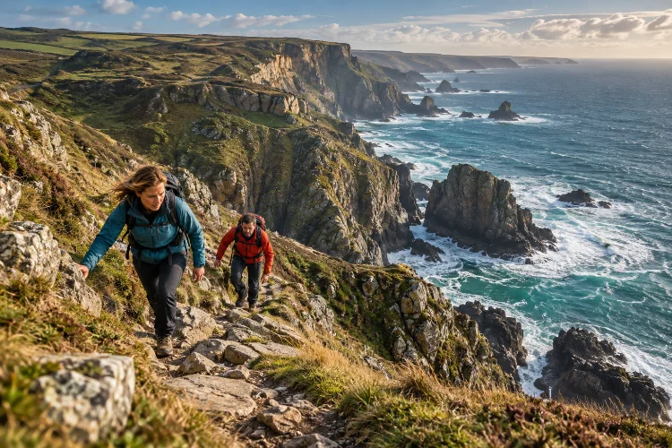
Cornwall looks made for walking, but its most spectacular coastal sections are rarely the easiest.
A route covering only ten miles can involve repeated descents almost to sea level, steep climbs back onto exposed headlands, rocky paths, slippery ground, strong Atlantic wind, and surprisingly few places to refill water.
That is why advanced walking routes along Cornwall’s most dramatic coastal sections should be chosen by terrain rather than mileage alone.
Nearly half of the South West Coast Path follows Cornwall’s roughly 300-mile coastline, with the Cornish section divided into stages ranging from relatively gentle coastal walking to some of the toughest terrain on the entire National Trail.
For experienced walkers, that difficulty is part of the attraction. West Penwith delivers granite cliffs and mining landscapes, North Cornwall adds deep valleys and enormous Atlantic views, while the Lizard and Roseland create equally dramatic routes with completely different geology.
The best walks combine physical challenge with enough planning to keep the day enjoyable rather than turning it into a race for the final bus.
Judge Cornwall Walks by Terrain, Not Distance
Experienced hikers often estimate a day by kilometres, but Cornwall can punish that habit.
Repeated valleys are the main reason. You may descend hundreds of feet, cross a stream or cove, then climb immediately back to the cliff top. Rocky ground and exposed sections slow progress even further.
The South West Coast Path classifies several Cornish stages as challenging or severe despite distances that might look moderate on paper. The important variables are gradient, surface, exposure, weather and how many escape points exist.
Always leave more time than the mileage suggests, particularly during shorter spring and autumn days.
Tackle St Ives to Pendeen for True Wild-Coast Walking
The St Ives to Pendeen stage is one of Cornwall’s serious walking days.
It covers about 13.7 miles or 22 kilometres and is officially classified as severe.
The route begins reasonably gently around Clodgy Point before becoming a succession of steep climbs and descents through the remote coastline around Zennor. Rocky and sometimes boggy ground makes progress slower than many walkers expect.
The reward is isolation.
This section has relatively few convenient facilities directly on the Coast Path. Refreshment stops normally require inland detours, so carrying enough water and food from St Ives is important.
For advanced walkers, that remoteness is precisely the appeal. Granite cliffs, hidden coves and long Atlantic views make this feel far removed from busy St Ives by the middle of the day.
Continue From Pendeen to Sennen for Mining Heritage
The following Pendeen to Sennen Cove stage is slightly easier but arguably just as visually impressive.
It runs for around 9.1 miles or 14.6 kilometres and is classified as moderate, although there is a short rocky scramble near Aire Point. The route passes Pendeen Watch, historic mining country and Cape Cornwall before approaching the huge sweep of Whitesand Bay.
This is one of the best places to combine walking with Cornwall’s industrial heritage.
Old mining landscapes sit immediately beside high Atlantic cliffs, reminding you how closely Cornwall’s extractive industries were connected with extremely exposed terrain.
Mining has shaped the county for thousands of years, with tin and copper becoming especially important historically.
If the full stage feels unnecessary, Cape Cornwall provides a shorter objective at roughly four miles from Pendeen.
Experience North Cornwall Between Bude and Crackington Haven
North Cornwall produces a different kind of difficulty.
The Bude to Crackington Haven stage covers approximately 9.8 miles or 15.8 kilometres. It begins relatively gently around Bude and Widemouth Bay before becoming much tougher as the path crosses rough terrain and drops into deep coastal valleys.
Scrade is particularly notable because it is described by the Coast Path as one of the deepest and steepest valleys on the Cornish section.
The scenery feels enormous here. High cliffs, Atlantic weather and broad views toward Hartland and Tintagel create a much more exposed atmosphere than Cornwall’s sheltered southern coast.
Keep something in reserve for the second half. The easy opening can make the day look less demanding than it really is.
Push Toward Tintagel for Sheer Cliffs and Deep Valleys
From Crackington Haven, experienced walkers can continue toward Tintagel.
The complete Crackington Haven to Tintagel stage is around 11.1 miles or 17.9 kilometres and moves from strenuous terrain toward somewhat easier walking later in the day. Sheer cliffs, deep valleys, birdlife and geological formations dominate the route
Boscastle provides a logical intermediate finish at approximately 6.7 miles or 10.8 kilometres. That option works particularly well if conditions are worse than forecast or your pace is slower than expected
There is also a current planning issue around Tintagel: the Coast Path reports a temporary diversion near Tintagel Castle following severe flooding and path damage in December 2025. Check the official route notice before walking rather than relying on an older GPX track.
That is a good example of why advanced coastal planning requires current information, not just navigational confidence.
Walk the Lizard to Coverack for Extraordinary Geology
For a completely different landscape, try Lizard Point to Coverack.
This 10.4-mile or 16.7-kilometre stage is rated moderate to strenuous. Short but steep climbs begin almost immediately, with harder terrain before Cadgwith and an easier approach toward Coverack later.
The geology makes this route special.
The path crosses serpentine, granite and schist, while some stiles are themselves made from polished-looking serpentine. Those surfaces can become slippery when wet, so footwear matters even when the forecast looks reasonable.
Kennack Sands creates a useful pause before another climb, while Black Head offers broad views toward Coverack Bay and farther along the south coast.
For a shorter version, finish around Cadgwith after roughly 3.5 miles.
Take Portloe to Mevagissey for South-Coast Drama
South Cornwall is sometimes described as gentler, but Portloe to Mevagissey quickly proves that assumption wrong.
The route covers about 12.2 miles or 19.6 kilometres. It begins with rough walking out of Portloe, becomes more pastoral around Caerhays, then turns strenuous again near Hemmick Beach and the climb toward Dodman Point.
Dodman rises roughly 375 feet above the sea and provides one of the great viewpoints on this stretch. Beyond it, the character changes again around Gorran Haven before easier paths lead toward Mevagissey.
This variety makes the stage particularly satisfying.
If 19.6 kilometres feels ambitious, Gorran Haven offers a shorter finish after about 8.8 miles or 14.2 kilometres
Build Escape Points Into Every Difficult Walk
Advanced route planning is not about assuming you will complete the full stage. It is about knowing exactly what to do if you do not.
Before leaving, identify villages, road crossings and bus stops where you can shorten the walk. Check public transport seperately on the day because seasonal and timetable changes can make an old itinerary unreliable.
Carry offline mapping as well. Mobile reception can be patchy on the Cornish coast, and official safety guidance recommends telling someone your route and expected return time.
Water, food, waterproof layers and a charged power bank belong in the pack even when the forecast appears good.
That little extra preperation gives you much more freedom once you are on the cliffs.
Treat Tides and Cliff Conditions as Route Variables
Some coastal hazards cannot be solved with fitness.
South West Coast Path guidance warns walkers to check tides before crossing beaches and to remain clear of cliff bases. Informal paths leading toward beaches can also be dangerous, while old mining districts may contain uncapped shafts away from established paths.
Wind matters too.
A strong Atlantic headwind can transform a moderate stage into a tiring one, particularly on exposed headlands. After prolonged rain, rocky and boggy routes such as St Ives – Pendeen can become considerably slower.
For serious walking days, check conditions that morning and be willing to reverse, shorten or abandon the planned stage.
That decision is not wasted effort. It is definately part of competent coastal walking.
Advanced walking routes along Cornwall’s most dramatic coastal sections offer far more than impressive mileage.
St Ives to Pendeen delivers remote granite terrain, Pendeen to Sennen combines Atlantic scenery with mining heritage, and North Cornwall adds steep valleys around Bude, Crackington Haven and Tintagel.
The Lizard introduces remarkable geology, while Portloe to Mevagissey proves that the south coast can be every bit as demanding.
Choose routes according to terrain and conditions rather than distance alone. Identify shorter finishes, check current diversions, carry enough supplies and allow extra time for rocky ground and repeated climbing.
Start with one challenging stage rather than linking several immediately. Cornwall’s dramatic coast is best enjoyed when you still have enough energy to stop, look around and appreciate why you climbed all those hills.