Inês Cardoso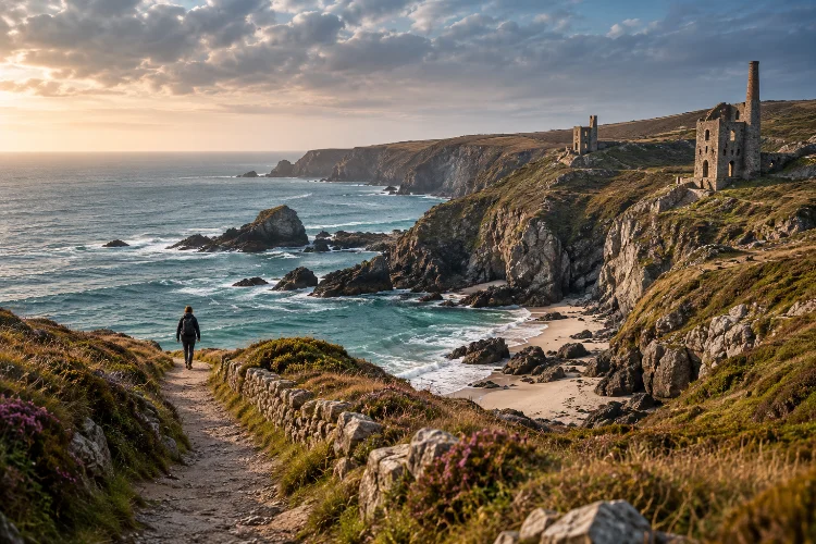
Cornwall’s coastline is famous for good reason. Places such as St Ives, Land’s End, Tintagel, and Fistral Beach deliver dramatic scenery, but they represent only one version of the county’s enormous coastal landscape.
Move a little farther from the headline attractions and the experience changes. Narrow lanes descend toward small coves, old military tracks cross lonely headlands, mining ruins appear above Atlantic cliffs, and sections of the South West Coast Path feel surprisingly remote.
Exploring Cornwall’s coast through less-traveled scenic routes is therefore not about finding places nobody knows. It is about choosing routes where the journey itself becomes more important than ticking off famous landmarks.
Some of these alternatives work best on foot, while others suit a slow road trip with short hikes along the way. The key is combining scenery with realistic distances, safe access, weather awareness, and enough time to stop when an unexpected viewpoint appears.
Start with the Rame Peninsula Instead of the Usual Western Hotspots
The Rame Peninsula sits in south-east Cornwall near Plymouth, yet parts of its coastline quickly feel much wilder than the nearby urban geography suggests.
One particularly rewarding option runs from Cawsand toward Rame Head and Whitsand Bay.
The official South West Coast Path route covers about 5.2 miles or 8.4 kilometres. The first section is relatively manageable, while the terrain beyond Rame Head includes steeper climbs and descents.
The attraction is variety. You move from sheltered Cawsand through woodland and coastal heath before reaching the exposed headland and wide views over Whitsand Bay.
There is history here too. Forts and defensive structures remain scattered around the peninsula, giving the route a different atmosphere from Cornwall’s classic fishing-village scenery.
One important current consideration is that coastal instability has caused closures and diversions around sections near Whitsand Bay, so check the official Coast Path updates shortly before travelling.
Slow Down on the Roseland Peninsula
If your mental image of Cornwall involves tiny lanes, green fields dropping toward the sea, and quiet beaches between wooded creeks, the Roseland Peninsula deserves serious attention.
Visit Cornwall describes the area as “the quiet coast” and notes that its maze of narrow lanes discourages some visitors from travelling much farther than St Mawes. The peninsula stretches between the Fal Estuary and St Austell Bay and forms part of Cornwall’s National Landscape.
Instead of simply driving directly to St Mawes, build a slower route around smaller coastal stops such as Portscatho, Towan Beach, St Anthony Head, and Nare Head.
Towan is particularly useful for travellers looking for a quieter shoreline. Visit Cornwall describes it as a secluded sand-and-shingle bay that generally avoids the intensity found at more famous Cornish beaches.
Do not underestimate the lanes, though. Driving distances may look short while actual progress is slow, so plan each section seperately rather than creating an overpacked day.
Walk Around Dodman Point for Big Scenery Without Huge Mileage
You do not need a twenty-mile hike to reach genuinely dramatic coastal terrain.
The National Trust’s Dodman long loop covers roughly 4.7 miles or 7.5 kilometres and takes around three hours. It crosses fields and the South West Coast Path before circling Dodman Point, the highest headland on Cornwall’s south coast.
The route passes Hemmick Beach and an impressive Iron Age earthwork known as the Bulwark. From the headland, views can stretch across Veryan Bay toward Nare Head, the Roseland, and even the eastern edge of the Lizard Peninsula in suitable conditions.
This is a good example of why lesser-known Cornwall works so well. Instead of spending the day transferring between multiple famous locations, you can dedicate several hours to one compact landscape.
Bring proper footwear. Parts of the trail are uneven, steep, and potentially muddy, while facilities on the headland itself are limited.
Take the B3306 Through Cornwall’s Wilder West
Not every scenic coastal route needs to be walked.
The B3306 between St Ives and Sennen is one of West Cornwall’s great drives. Visit Cornwall highlights its sweeping Atlantic views as the road passes ancient fields, small settlements, rugged moorland, and the remote western coastline.
The difference between rushing this road and properly exploring it is enormous.
Stop around Zennor, then consider sections near Gurnard’s Head, Pendeen, Botallack, and St Just. From St Just, leave the obvious route toward Land’s End and make the short detour to Cape Cornwall instead.
Visit Cornwall specifically presents Cape Cornwall as a quieter alternative to Land’s End. The surrounding Tin Coast also preserves extensive remains from Cornwall’s historic mining industry
This is a route where accomodation in one base often works better than constantly moving. Stay around St Just or Penzance and explore different sections depending on the forecast.
Look Beyond Famous Beaches in West Penwith
West Penwith is also ideal if you want smaller coves rather than full-scale beach resorts.
Visit Cornwall identifies the region as one of Cornwall’s quieter areas, with narrow roads linking small communities beneath high, rugged cliffs. Its guide to secluded beaches includes places such as Gwynver, reached via a steep path from above.
At low tide, Gwynver connects with neighbouring Sennen Beach, while the Coast Path toward Cape Cornwall provides broad cliff-top views.
These places require a different attitude from visiting a large accessible beach. Parking may be limited, paths can be steep, and mobile reception should never be assumed.
That small inconvenience is part of the appeal. You arrive more slowly, spend longer in one place, and experience the coastline at a more natural pace.
Combine Porthleven, Loe Bar, and Gunwalloe
Another rewarding alternative lies around Porthleven and the Penrose Estate.
From Porthleven, the South West Coast Path runs toward Loe Bar, separating the sea from Loe Pool. From there, routes continue south toward Gunwalloe and quieter stretches of the Lizard coastline. The National Trust maintains several walking options through this landscape.
One circular route from Chyvarloe to Gunwalloe Fishing Cove is approximately 3.25 miles or 5.2 kilometres and combines coastal views with inland fields and part of Loe Pool
There is an important safety point here: swimming at Loe Bar is not permitted because of dangerous currents and tides
That is worth remebering because a beautiful empty-looking beach is not automatically a safe swimming beach.
Build a Route Around Landscapes, Not a Checklist
The easiest mistake when exploring quieter Cornwall is attempting to see too many supposedly “hidden” places in one day.
Instead, group locations geographically. A western day might combine Zennor, Pendeen, Cape Cornwall, and a short Coast Path section. A Roseland day could focus on St Anthony Head, Towan Beach, and Portscatho.
For the east, connect Cawsand, Rame Head, and Whitsand Bay.
This geographical approach reduces driving and creates more room for spontaneous stops. It also makes changing plans easier when fog, wind, rain, or trail conditions interfere.
Before walking, check current Coast Path information rather than depending entirely on an old guidebook. Coastal erosion occasionally creates diversions, and conditions can change between seasons.
A slower route may cover fewer kilometres, but it will almost definately reveal more of Cornwall.
Exploring Cornwall’s coast through less-traveled scenic routes opens up a different kind of Cornish trip.
Instead of moving between the county’s biggest attractions, you can follow wild headlands around Rame, wander the quiet lanes of the Roseland, circle Dodman Point, explore West Penwith, or walk from Loe Bar toward Gunwalloe.
The best approach is deliberately slow. Choose one geographical area each day, combine driving with short sections of the South West Coast Path, and leave room for weather changes and unexpected discoveries.
Before setting out, check current trail conditions, tides where relevant, parking, and public transport options. Then put some space into the schedule. Cornwall’s quieter coastline becomes much more memorable when you have enough time to actually explore it.